Billows, Kentucky
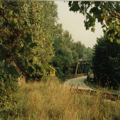
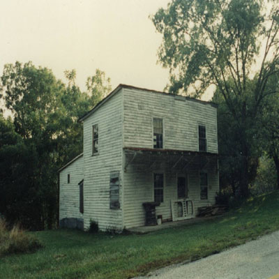
Billows, Kentucky is located at the adjunct of Pulaski, Laurel, and Rockcastle counties lines.
It is located where the old Evans Ferry crosses the Rockcastle River and the old route 80 Rockcastle
Bridge spans the river. The steel bridge has been replaced with a new concrete bridge since the picture
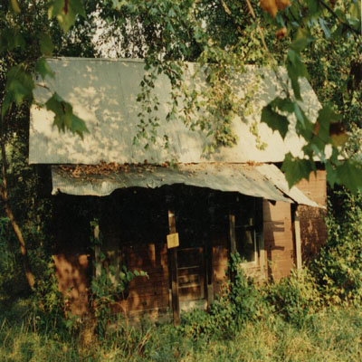
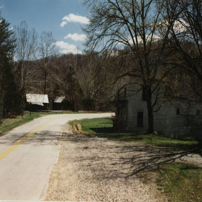
was taken. The top right picture is the general store and former post office of Billows which has been
abandoned. The top left picture is taken from the western perspective of the seeming ghost town. These
photos were taken during 1980. A tavern was located on the other side of the bridge. It was located
immediately on the right side of the road. This tavern was a silver painted log structure which burned
down during the year 1966. Just past the tavern, on the left of the road, the Hawk Creek wagon road is
located on the northern side of the Rockcastle River.
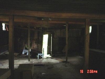
Inside the Billows General Store, there is still the store's service counter in the merchandise area.
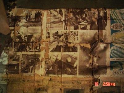
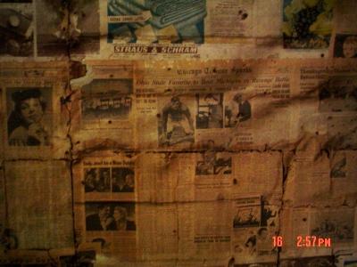
Within the upper store's bedrooms, there are 1930s era newspapers which line the walls for insulation. Pictures
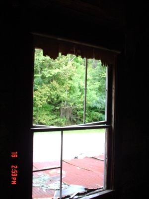
on the newspapers are still visible and readable and are a great look back into time. These four photos
were taken during the fall of summer of 2011.
“The community of Billows centers around the bridge which spans the Rockcastle River. The Evans
Ferry is located at the same location. This was the traditional departing point from Pulaski County
to Mount Vernon in Rockcastle County or London in Laurel County. If people were traveling up the Wilderness
Trail up to the town of London, they could easily detour to the pioneer station at Mount Vernon or they could
press on to the town of Somerset which is located on a former Indian town.
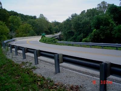 This is the new Rockcastle River Bridge which overlooks the Evans Ferry location at Billows. The perspective
is from the Rockcastle County side.
Perhaps the county's greatest historical significance derives from the roads leading through it. Two major
thoroughfares, the Wilderness Road and Scaggs' Trace, ran through the county, ushering hundreds of thousands
of pioneers into Kentucky in the late 1700s and early 1800s. For most families, the section which would become
Rockcastle County wasn't a destination–it was a part of a long journey to a hoped-for better life.
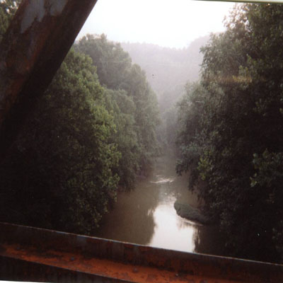
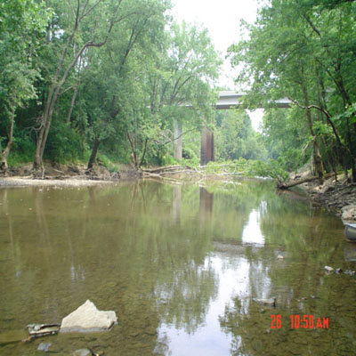
This bridge has been replaced with a concrete structure bridge. The photo on the right looks north from the
Evans Ferry location below the new bridge.
The road’s passage was very rough and strenuous for the pioneer travelor. The western part of the county,
especially the lower part of the Skeggs Creek watershed, never had the transportation advantages afforded
by the improved infrastructure. Although used more heavily than the Wilderness Road early on, Scaggs' Trace
was an incredibly rough path, with numerous difficult creek crossings. Other than coal extraction, there was
no industry to speak of in the western section. Families living there were more reliant on farming and seemed
to connect more with eastern Pulaski County families than with those who lived in Mt. Vernon, Pine Hill, or Livingston.
at the Laurel and Pulaski counties lines.
Native Americans used the Rockcastle area as they used much of Kentucky, as hunting grounds and temporary camps.
There is evidence on the south section of the East Fork of Skeggs Creek and on Eagle Creek near the Rockcastle
River of perhaps a more permanent inhabitance, at least of the establishment of returned-to encampments
“ (retrieved on 9 April 08 from http://kenrocky.com/history.html).
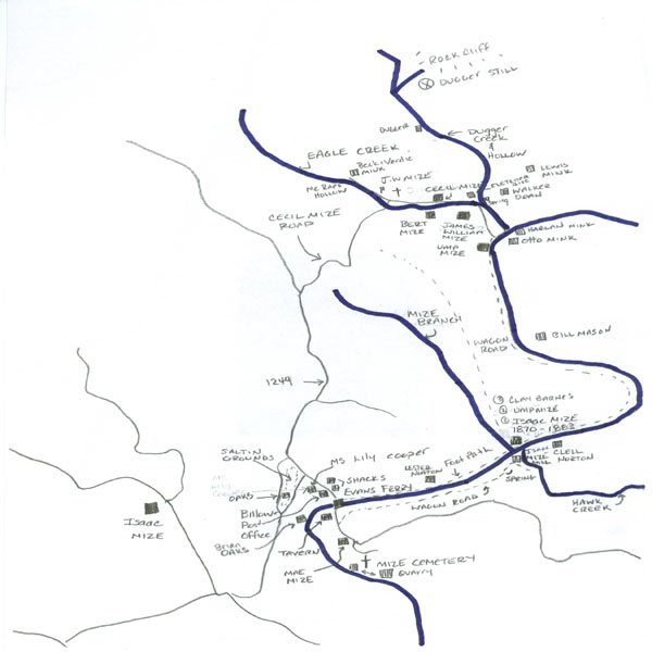
The sketch was made with the help from Damon Mize, the author of the book, Borned into Hell, which is the story
of his life on Eagle Creek that runs into the Rockcastle River. The homes located on the drawing existed during
the 1930s and 1940s.
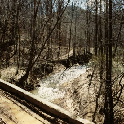
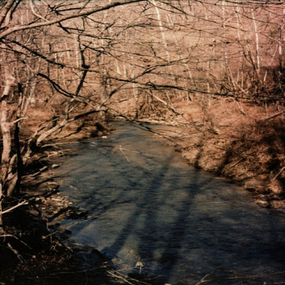
The left and right photos are pictures of Hawk Creek looking upstream from Hawk Creek Road Bridge. Hawk Creek
Road can be seen in the background in the photograph on the left. The stream is a well known Trout release
stream. Boundary markers with the letters “AD” which stood for Andrew Decker are at the confluence of Hawk Creek and
Rockcastle River. The bridge is no longer accessible because the dirt road has been covered by land slides and felled
trees and access. The entrance of the old Hawk Creek road is presently blocked with a dirt berm. On the southside of the confluence of Hawk Creek
and Rockcastle River is the supposed site of Isaac Mize’s mill. The below photo shows the site. This grist mill was known
throughout the region and is mentioned in numerous legal papers. The Rockcastle River is just below the tree line and Hawk
Creek is to the right of the photo. This photo was taken during the winter of 1980. The mountain in the background is located
across the Rockcastle River in the Eagle Creek valley where the J. W. Mize family lived.


This photo is the Hawk Creek Wagon Road, which is located along the eastern side of the Rockcastle River
below the old Hawk Creek Road.
The wagon road runs from Billows past the Hawk Creek Bridge and for another half mile until it terminates.
This was a major transportation
route for the residents living on both sides of the river especially during spring months when river
water levels are high. The road can
be easily detected during fall and winter months.
A Mize Cemetery is located within the former rock quarry located on the right side of the Somerset London Road aka Old Route 80 just past
Hawk Creek Road when heading east from the bridge. The Mize Cemetery is located on the south side of the through road and it is not visible
from the main road. The cemetery has numerous unmarked graves within the site and several gravesites are marked with hand hewn stones. It is
presumed that members of “Ump” , Humphrey Mize’s family is buried at this cemetery. Two Mize family members are buried within the cemetery
with marked headstones. Robert Mize and James Logan Mize have marked tombstones in this cemetery. The cemetery is located between two water
filled rock quarries which was a former site for a government Civilian Conservation Corps number F11 work project which took place during the
1930’s. The quarry was mined for rock which was used to build roads or to upgrade dirt roads to gravel roads.

This photo shows the hand hewn and unmarked stones within the cemetery. There are numerous depressions indicating graves in the cemetery that
are not marked with gravestones. The cemetery is very isolated and has a lonely feeling to it. Each time that I have visited the site, there
have been flowers on most of the graves. The cemetery has a barbed wire fence surrounding it and an outbuilding. It has changed very little
over the years.

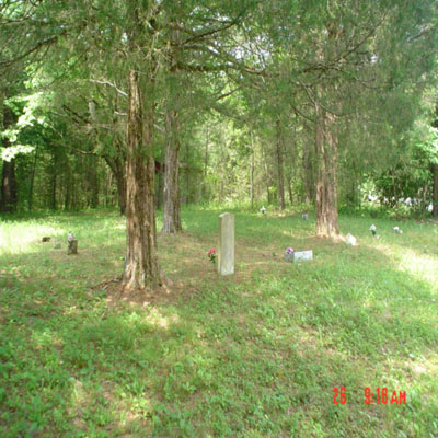
The access road, pictured on the left, is gravel and easily traveled down from the Old Route 80. There is a myriad of roads which can make finding
the cemetery somewhat difficult. The photo on the right shows the cemetery during the summer months. The gravestone in the center is for Robert
Logan Mize who was a quartermaster soldier during World War I. The quarry was the site of a murder
burial during 2010. A mother with from her sister, killed the mother's child in London, Kentucky.
Then, then the two sisters dismembered and buried the child somewhere within the rock quarry. The child
was later recovered
by Laurel County Police. The rock quarry or “fury hole” which it is common nicknamed by locals has supposedly been the site of many murders and midnight burials.

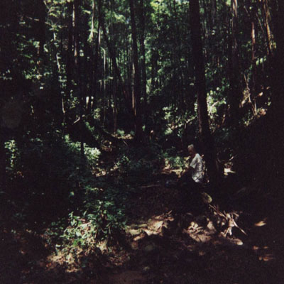
Damon Mize and myself made a trip up the Rockcastle River during the year 1990 to visit different family sites located on the banks of the river
and on Hawk Creek, Eagle Creek and Mize Branch. The upper left photo was taken when we crossed the Rockcastle River from the Hawk Creek wagon
trail to the Mize Branch. The crossing made the trip a soggy venture for the rest of the day. The
upper and lower right photos were taken
walking up Mize Branch. As you can tell, the vegetation and overgrowth is very dense and makes walking
slow and tenuous. We stopped at several
places where houses once stood next to the river. Damon explained who lived in the houses and how the
houses where constructed. Some of the ruins had radio
antenna wires, still attached to house frames, running to nearby tree trunks. The fireplace hearths were still
recognizable for some of the homes.
Isaac Mize, our progenitor, lived on Mize Branch around 1870 but the homesite location is not known. Damon is barely discernable in the photo on the right
because of vegetation cover.
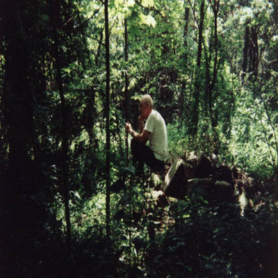

The top left picture shows Damon taking a rest on top of a house chimney. These sites are barely visible
and hard to locate but we were able to find several home foundations as we walked the heavy brush
toward Eagle Creek.
<\p>

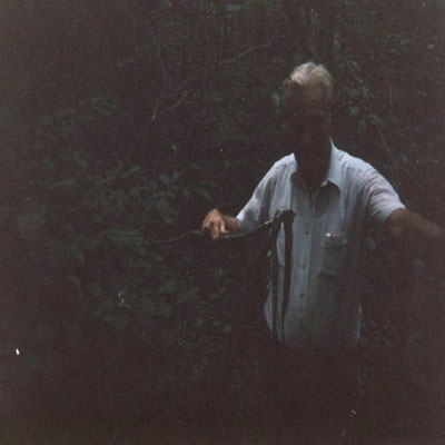
The picture is the wilderness which pioneers including us would have to hack a trail through. The
underbrush has a lot of
“trip me vines”, "wait a minute plants", and lots of animal life. This includes poisonous snakes such
as mountain rattlers and copperheads.
Damon had told me to be watchful especially for copperheads while we were walking as he walked within
inches of a coiled up copperhead lying
under a May Apple plant. I laughed and told him “like the one you almost stepped on!” I picked up a
rock and killed the copperhead with it.
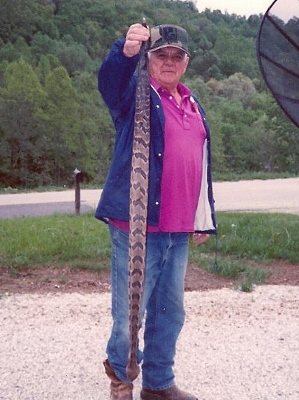
We had a good laugh about it. It was about three foot in length as you can see in the picture.
On another trip to Eagle Creek with Shelby Mize, he told me about killing a huge mountain rattler near a
woodpile located in his back yard. He killed it and then stretched it across the drive way.
It stretched from side to side of the driveway. Mountain Rattlers are a fairly common occurrence in
this region of eastern Pulaski, Laurel and Rockcastle counties. It is a pretty
good sized snake! Shelby always carried a holstered pistol when out in the woods and he really enjoyed
hunting for snakes.
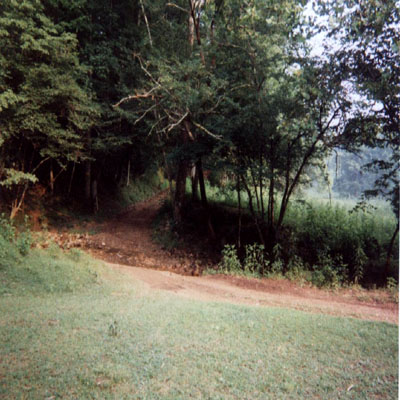
 All the
pictures were taken at mid-day
during our trip but the lush greenery is so thick that the sun does not filter down to the ground very
well. It makes for a dark adventure. There were wait-a-minute vines which grabbed you at every step and
the walking was slow at times. The paths that once ran along the Rockcastle River between households are
long gone and not discernable within the thickets and plants overgrowing the trails. I believe that there
was a myriad of trails which lead from the James Mize farm to Billows and other points close by and was told
by Damon that there were numerous households located on the river. He found several household sites on our trip
along the river. The trip was a great time together; especially learning the lay of the land and the
community which eeked out a living in the remote parts where the three counties adjunct. It seemed a
convenient place to step across the county line to another county to elude enemies or outfox the law. If
tombstone could talk, the stories would fill libraries with books. The air was motionless during this
trip, the bugs thick, the temperature hot and the humidity was smoldering. It felt like I had
taken a shower without a bathroom. I have to say that I still yearn for another trip down the river and up
to Mize Branch, Hawk Creek, and Eagle Creek on a typical humid Kentucky summer
day and it would not be complete if it was not filled with chiggers,
ticks, and mosquitos……
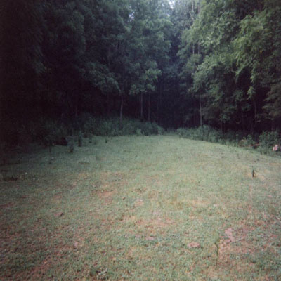
We walked up Eagle Creek to where Dugger Creek runs across the Eagle Creek gravel road just past the J. W. Mize farm
site. The picture on the left
is this intersection. This is where Damon was shot in the chest as a kid by a neighbor. The next
picture is where Fletcher Rice’s home stood
next to Dugger Creek. Dugger Creek runs through Dugger Hollow. The Dugger home was located about a mile
from the Rice house. It is reported the Dugger family
had a moonshine still located under a rock cliff located farther north up the creek from the Dugger house. The still
was renown for its production in the Eagle Creek area.
The opening in the center back of the Rice house site is Dugger Holler. Immediately to the right of the
photo is Dugger Creek. The creek has a square “cup dip” carved in the creek bed.
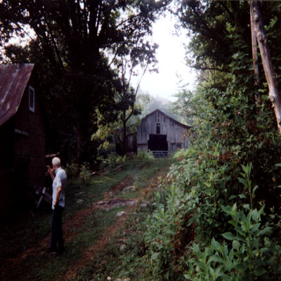
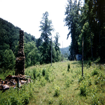
We stopped at the Cecil Mize Family farm to take a rest and some more pictures. The house is in excellent condition, along with a barn and
outhouse! The right photo is the Cecil Mize farm site. The last stop was at the Herb Mize home site. The house has burned down but the
chimney still stands. This is the family home site for Damon and is the setting for his book “Born into Hell”. The Herb Mize, Damon’s father,
home site is directly across Eagle Creek from the Cecil Mize home.

I parked the car next to the spring located below the Herb Mize home site. This is the same spring that
is stated in Damon’s book where his mother walked down to after
being shot by Damon’s father Herb Mize. The creek in the foreground is Eagle Creek and the dirt road,
Cecil Mize Road aka Eagle Creek Road, which leads to main
blacktop road. It is the only road into the valley to the James William Mize property. The road has been upgraded with gravel and a bridge
built over Eagle Creek to access the property. The first time when I visited the property, the road was dirt covered and a creek crossing
was necessary to travel the length of the valley. The clay road turned quite slippery during a rain storm. The Herb Mize Cemetery is located just past the end
of the road pictured on the right hand side of the road. It is very overgrown and difficult to find. A Civil War Union Soldier is buried in
the same cemetery.

Damon told me about a story where his cousins had lived in this house located at the Saltin Grounds. He said that a shoot out had occurred there
between Oak family members.. The location of the Saltin Grounds is on the sketch.


 This is the new Rockcastle River Bridge which overlooks the Evans Ferry location at Billows. The perspective
is from the Rockcastle County side.


 All the
pictures were taken at mid-day
during our trip but the lush greenery is so thick that the sun does not filter down to the ground very
well. It makes for a dark adventure. There were wait-a-minute vines which grabbed you at every step and
the walking was slow at times. The paths that once ran along the Rockcastle River between households are
long gone and not discernable within the thickets and plants overgrowing the trails. I believe that there
was a myriad of trails which lead from the James Mize farm to Billows and other points close by and was told
by Damon that there were numerous households located on the river. He found several household sites on our trip
along the river. The trip was a great time together; especially learning the lay of the land and the
community which eeked out a living in the remote parts where the three counties adjunct. It seemed a
convenient place to step across the county line to another county to elude enemies or outfox the law. If
tombstone could talk, the stories would fill libraries with books. The air was motionless during this
trip, the bugs thick, the temperature hot and the humidity was smoldering. It felt like I had
taken a shower without a bathroom. I have to say that I still yearn for another trip down the river and up
to Mize Branch, Hawk Creek, and Eagle Creek on a typical humid Kentucky summer
day and it would not be complete if it was not filled with chiggers,
ticks, and mosquitos……


